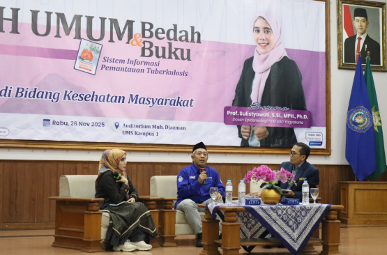
Surakarta — The Public Health Study Program, Faculty of Health Sciences, Muhammadiyah University of Surakarta (UMS Public Health) held a Public Lecture and Book Review on Wednesday, November 26, 2025, at the Mohammad Djazman Auditorium, UMS Campus I. This event is part of an effort to strengthen student literacy and capacity in the use of health information technology.
The keynote speaker was Prof. Sulistyawati, S.Si., M.P.H., Ph.D., an expert in Epidemiology and Health Systems. In her presentation, she outlined various GIS applications in the health sector—from health facility planning, service accessibility, logistics distribution, disease spread mapping, to mitigating health risks from disasters and environmental conditions. According to Prof. Sulistyawati, the use of spatial visualization helps clarify disease patterns and risk conditions, thus supporting evidence-based decision-making.
Dr. The presentation was presented by Dr. Noor Alis Setiyadi, S.K.M., M.K.M., Ph.D., a lecturer in Public Health at UMS and author of the monograph “WebGIS-Based Tuberculosis Monitoring Information System.” In his presentation, Dr. Noor Alis encouraged students to be more creative in choosing their final project topics—especially those that touch on health information systems. He emphasized that spatially monitored and visualized health data can be an important basis for planning public health interventions and policies.
Furthermore, Dr. Noor Alis emphasized that the application of GIS is not only relevant for infectious diseases such as tuberculosis (TB), but can also be extended to monitoring non-communicable diseases (cancer, chronic diseases), environmental health, and other public health issues—including mental health.
This activity aligns with the vision of the UMS Public Health Study Program to integrate information technology into public health education and practice, enabling students to become not only proficient in epidemiology and public health but also competent in data management and spatial analysis.
The UMS Public Health Study Program hopes that through this public lecture and book review, students will be able to develop analytical and technical capacity in health mapping using GIS, produce research and community service based on spatial data, so that health interventions can be more targeted, and initiate WebGIS applications across various health issues—from infectious diseases to environmental health and broader public health.
Thus, the UMS Public Health Study Program hopes its contributions will strengthen health information systems at the community and government levels—as part of efforts to realize a healthy society through mapping, data, and evidence-based interventions.